Maine Historic Preservation Commission
The Maine Historic Preservation Commission maintains an inventory of important sites including buildings or sites on the National Registry of Historic Places (NRHP). They record four such listings for the town of Machiasport.
Liberty Hall www.libertyhallmaine.org
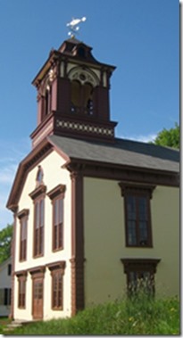
Liberty Hall
Liberty Hall was built 100 years after the Boston Tea Party. Designed by Machias architect Andrew Gilson and constructed at a cost of about $8,000. Its frame structure was built in 1824 and improved in 1949. The tower was built in 1848 of granite, in a conical design, a 42’ white beacon that has remained basically unaltered to this day.
Liberty Hall stood at the center of the Town’s bustling prosperity and served as the center of the town social activity. Audiences packed the house regularly scheduled vaudeville shows, theatre productions, political rallies, basketball games, town festivals and suppers and Town Meetings. The building’s Great Hall has excellent acoustics and a large graceful stage. Liberty Hall was used as the town office for many years.
Click here to read about the restoration of Liberty Hall (pdf).

Liberty Hall
The Machiasport Historical Society
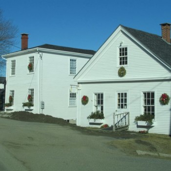
The Gates House – Machiasport Historical Society
The Machiasport Historical Society was founded in 1964, owns the Cooper House and the Gates House, and holds a collection rich in Washington County history. Collections include circa-1800 school room, a collection of historic ship models and marine charts and maps, period furnishings and paintings, textile collection, an extensive group of antique marine, blacksmith, and wood-working tools, and an early 20th century post office.
The Gates House was named, after the 1813 sale of Zebedee Mayhew’s house, barn, store and wharves at public auction to Nathan Gates. From the mid-nineteenth century, the wharves were the final stop on the Machiasport- Whitneyville Railroad. The narrow-gauge wooden railed railroad was one of the first in the state. The basement facing the river was always used as a store or trading port.
Fort O’Brien Historical Park
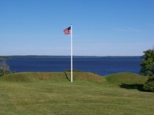
Fort O’Brien Historical Park
Fort O’Brien Historical Park was built after the capture of the British ship, “Margareta”. Originally named Fort Machias, Fort O’Brien was upgraded by Massachusetts in 1777 and taken over by Congress in 1781. The Continental Congress took over control of the structure in 1781. Fort O’Brien suffered no further attacks during the Revolutionary War. It was next returned to active service during the War of 1812. In 1814, Fort O’Brien was captured by 900 British regulars, who removed the fort’s guns and burned the barracks. Fort O’Brien once again activated (for a final time) during the Civil War when an entirely new battery was constructed just south of the 18th century fortifications. Fort O’Brien, which is now a State Historic Site under the management of the Bureau of Parks and Lands, is also listed as an archaeological site. The Fort was attacked in 1814 by the British and abandoned. It was activated again in 1863 at the height of the Civil War and refortified. It is now called Fort O’Brien Historical Park and is a State Park on a prominent earthwork overlooking the Machias River.
The Cannon at Fort O’Brien
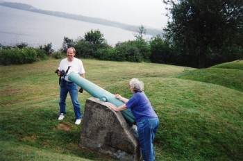
Cannon at Fort O’Brien Historical Park
In the middle of the earthworks of the Civil War era battery is bronze cannon known as a “Napoleon” or 12-pounder. It fired 12 pound cannonballs, spherical case shot, or canister, the latter being made up of numerous small pieces of iron that tore through infantry formations or a ship’s rigging at close range. This cannon tube weighs 1216 pounds and was made at the Ames Manufacturing Company of Chicopee, Massachusetts in 1862. It originally sat on a wooden carriage that weighed an additional 1128 pounds. In optimal conditions, this gun could fire a ball 1600 yards, just enough to reach across the mouth of the Machias River. The cannon was “lost” for many years. Once the cannon was relocated the 250th Committee, partnering with the Downeast Correctional Facility, Machiasport Historical Society developed a plan to return the cannon to the Fort O’Brien Historical site in July 2013 for the public to enjoy once again.
Federal Aviation Administration (FAA)
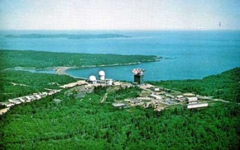
Bucks Harbor Air Force Station
Bucks Harbor Air Force Station is a closed United States Air Force General Surveillance Radar station. located 7.0 miles south-southeast of Machias, Maine. It was closed in 1979 by the Air Force, and turned over to the Federal Aviation Administration (FAA.)
Today the site is part of the Joint Surveillance System (JSS), designated by NORAD as Eastern Air Defense Sector (EADS) Ground Equipment Facility.
History
Bucks Harbor was part of a planned deployment of forty-four Mobile radar stations in 1952, designated as a “Phase I Mobile Radar station”. The station was designed to provide protection to Loring AFB. It was originally planned to be located at Corea, Maine, but in 1953 the Navy feared that the proposed site would interfere with a nearby radio interception and direction-finding facility.
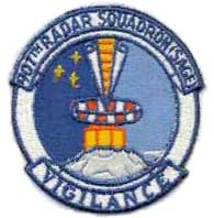
 Funding, constant site changes, construction, and equipment delivery delayed the completion of Bucks Harbor AFS until 1955 when the 907th Aircraft Control and Warning Squadron (AC&W Sq) was moved from the Manual Air Defense Control Center (ADCC) at Syracuse AFS, NY on 1 March 1956. At Bucks Harbor, the 907th AC&W Sq began operating an AN/MPS-11 radar, and initially the station functioned as a Ground-Control Intercept (GCI) and warning station. As a GCI station, the squadron’s role was to guide interceptor aircraft toward unidentified intruders picked up on the unit’s radar scopes. In 1959 an AN/FPS-8 came to Bucks Harbor and this set subsequently was converted into an AN/GPS-3. In 1960 two AN/FPS-6A height-finder radars were activated and the site.
During 1959 Bucks Harbor AFS joined the Semi-Automatic Ground Environment (SAGE) system, feeding data to DC-05 at Topsham AFS, Maine. After joining, the squadron was designated as the 907th Radar Squadron (SAGE) on 1 October 1959. The radar squadron provided information 24/7 the SAGE Direction Center where it was analyzed to determine range, direction altitude speed and whether or not aircraft were friendly or hostile. On 31 July 1963, the site was redesigned as NORAD ID Z-110.
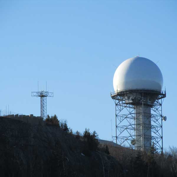
Over the years, the equipment at the station was upgraded or modified to improve the efficiency and accuracy of the information gathered by the radars. By 1963 Bucks Harbor operated with an AN/FPS-24 search radar and AN/FPS-90 and AN/FPS-6B radars. Around 1965 Bucks Harbor became a joint-use facility with the FAA.
The 907th was inactivated on 30 June 1979.
Over the next two years preparations were made to turn over the facilities to the State of Maine and the Federal Aviation Administration (FAA). It was designated as Joint Surveillance System (JSS) site J-54. Although the FAA assumed control of the operations area with the inactivation of the 907th, the Air Force continued operating the AN/FPS-90 height-finder radar until 1988. In 1995 the search radar consisted of an AN/FPS-66A radar until 1988 when it was removed.
In the late 1990s the AN/FPS-66A search radar was replaced by the modern ARSR-4 radar. The containment area now is used by the State of Maine as a correctional facility, the housing area being owned by the State of Maine.
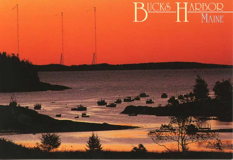
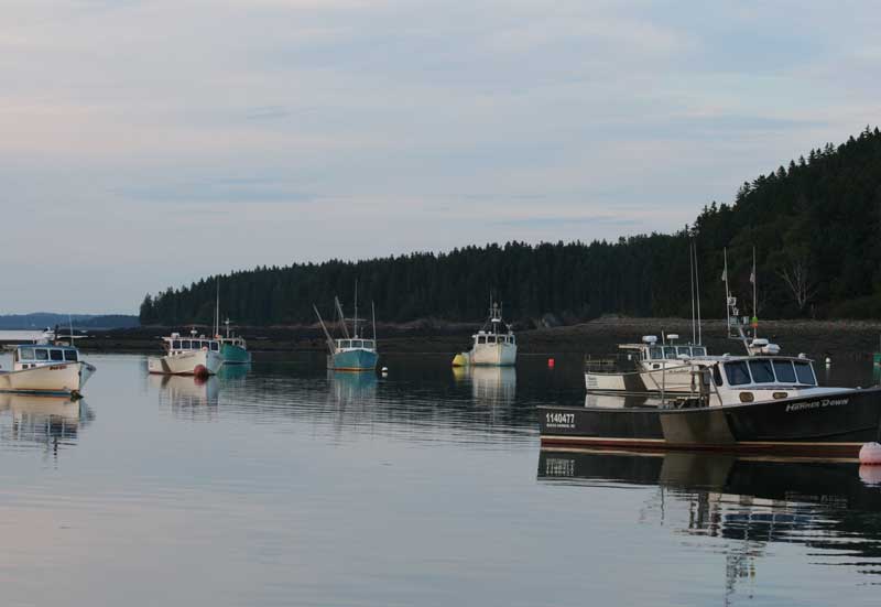
Bucks Harbor
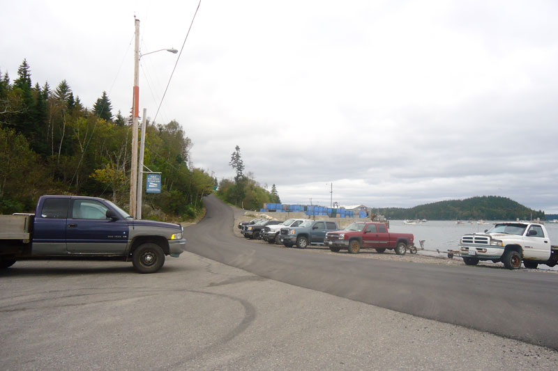
Public Access to the Shore
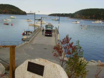
Bucks Harbor Pier
The Machiasport Maritime Management Plan identifies 14 public facilities that provide access to the shore for recreational and/or commercial users. These include both town owned and other public facilities. Public access points are a major source of access for commercial fishermen as well as providing important access for recreational use for the public. The Bucks Harbor Municipal Pier, Finn Beach and the Public Boat Ramp provides vital access for Machiasport commercial fishermen and the public as well.
Public Boat Access
Public Boat Access on Pettegrow Point Road
Jasper Beach Park at Howard’s Cove
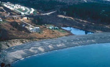
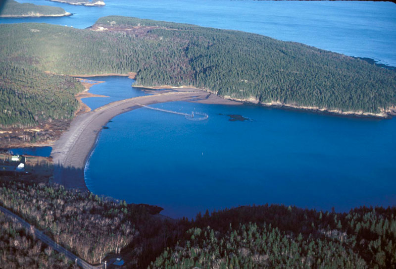
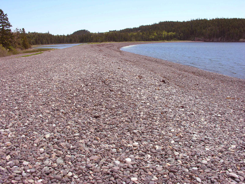
Jasper Beach
Jasper Beach is located in Howard Cove, Machiasport, just west of Machias Bay. It is dominantly a gravel beach. Bedrock frames Howard Cove making Jasper a pocket beach. It is also a barrier split that originates at an eroding bluff of glacial material on the west and terminates at a tidal inlet on the east. In addition the beach is cracked by fresh and saltwater lagoons, and a salt marsh. Jasper Beach is located on Port Road (Route 92) and it is owned by the Town of Machiasport and is a Town Park.
Click here to read The Billion, Billion Stones of Jasper Beach, Chris Mackowski on August 11, 2010 in Leisure & Travel.
Archeological Sites “The Picture Rocks”

Petroglyphs
According to the Maine Historic Preservation Commission (MHPC) there are nineteen known prehistoric archaeological sites (Native American, before European arrival) located within Machiasport. They are all petroglyphs (rock carvings) and all are located in the coastal zone. Five petroglyph sites are listed on the National Register of Historic Places. MHPC indicates that reconnaissance-level survey in the coastal zone is mostly complete but intensive-level survey and site conservation work is needed at most sites. Exact locations of the petroglyphs are not mapped in order to protect their integrity.
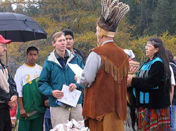
MCHT president Jay Espy hands Passamaquoddy Chief Rick Doyle the deed to the Picture Rocks lands in Machiasport. As part of the agreement MCHT received a conservation easement on 300 acres of nearby Passamaquoddy land at Moose Snare Cove in Machiasport.
Under terms of the agreement, MCHT receives a no-development conservation easement on 300 acres of nearby Passamaquoddy land with frontage on Moose Snare Cove (about two miles from the Picture Rocks site). The easement allows for forestry and continued agricultural use, such as blueberry production. The easement expands to more than 1,000 acres the protected lands in this ecologically sensitive area. MCHT facilitated the acquisition of the Picture Rock site on behalf of the tribe in order to complete the easement agreement on the Moose Snare Cove site. The transaction was made possible thanks to a cooperative private landowner.
“The Picture Rocks” site is perhaps the most important petroglyph site in Maine. We had concerns that this land could one day go up for development, that we could lose the archaeological and cultural heritage of the petroglyphs,” said Mark Hedden, archeological consultant to the Maine Historic Preservation Commission. Hedden, along with representatives from the tribe, the University of Maine at Machias, MCHT, and local community members have established a committee , named Malusah’ekan, which is Passamaquoddy for “Picture Rocks on the Shore) that is working to protect other petroglyph sites in the Machias Bay area. The committee hopes that the success of this project will be a catalyst for further protection of these historic sites.
Now that the tribe has control of the site, it plans to offer guided tours with tribal members interpreting the petroglyphs and explaining their history, but first a long range management plan must be developed.
About the Passamaquoddy Tribe
The Passamaquoddy Tribe has a long history in eastern Maine and western New Brunswick Canada, some say over 12,000 years. Machiasport is a very unique place, a place where the coast soothes the spirit and the land heals the soul. This petroglyph site is in an area of the largest concentration of rock carvings on the east coast. After 400 years, the rock carvings return back to the ancestors of the people who created them, what a strong story of endurance and survival. For more information, visit www.wabanaki.com.
Discovering Maine’s Down East Heritage Trail
By Resident Jim Harnedy
Just off the beaten path at the foot of the University of Maine at Machias College Hill where Routes 1 and 92 intersect an amazing 11 mile trek steeped in history, culture and exciting natural wonders awaits the adventurous. Click here to read more….
Islands in Machiasport
- Bar Island
Ingalls Island
- Bare Island
- Big Libby Island 96 1 Maine Dept. of Inland Fisheries & Wildlife
- Chance Island
- Feather Bed Island
- Foster Island
- Hog Island 31 1 Maine Dept. of Inland Fisheries & Wildlife
- Ingalls Island (AKA Starboard Is.)
- Little Hog Island
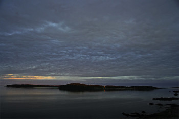
- Little Libby Island 39 1 US Department of Interior
-
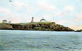
Libby Island Light
Porcupine Island
- Ram Island
- Round Island -Town of Machiasport
- Salt Island -The Nature Conservancy
- Scabby Island 18 1 –
- Stone Island -The Nature Conservancy
- Yellow Head Island
- The Head -Maine Coast Heritage Trust
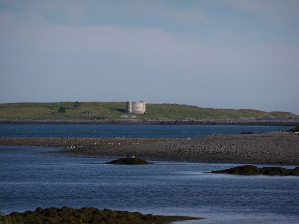
Castle on Foster Island
The Yurt Foundation www.yurtinfo.org
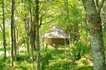
Yurt
The Yurt Foundation is a nonprofit educational organization established to gather folk knowledge from the cultures of the world and place it in a contemporary framework, thereby creating a reservoir of ideas for designing ways of living that are simpler, more beautiful and more just. The Yurt, as modified by Bill Coperthwaite, is a symbol of this cultural blending, combining the folk wisdom and design of ancient Mongolia with the modern materials of milled lumber, glass, and steel aircraft cable.
The Yurt Foundation homestead in Maine has been an experiment in cultural blending and simple living. Since the release of A Handmade Life in 2004, Bill has continued work on a series of children’s books about a young fellow named Willie growing up at the homestead. Books on hand tools are also in the works.
Additionally, the Archives Project was started in 2008 with the goal of making information from the Yurt Foundation archives accessible to a world-wide audience through an online website.
Bill Coperthwaite Mill Pond and his Concord is located in Bucks Harbor This three-story yurt is reachable only by the sea, or by a half-hour hike along a woodland footpath bordered by bunchberry and sphagnum and hair cap moss. Coperthwaite is highly learned — he earned a Ph.D. in education from Harvard in 1972. He moved out of the mainstream decades ago to pursue simplicity and self-sufficiency.
Down East Correctional Facility (DCF)

The Downeast Correctional Facility has a small garment shop operation which employs ten (10) inmates. They produce all the jeans and jean jackets worn by our prison population. Jean kits are purchased from the Oregon Department of Corrections and stitched at Bucks Harbor.
64 Base Road
Machiasport, Me 04655
207-255-1100
Director, Scott Jones is a long time correctional employee.
Number of employees: 55 – all employees live in Machias/Machiasport and surrounding communities
Number of Prisoners: 149 minimum security prisoners
The Downeast Correctional Facility (DCF) , located at the former Bucks Harbor Air Force Station, was established by the Legislature in September 1984. Funds were appropriated to purchase the facility for the confinement and rehabilitation of persons who have been duly sentenced and committed to the Department of Corrections and began receiving inmates in June 1985.
 DCF Programs offered include:
- Differential Substance Abuse Program – meets twice a week for ten weeks
- Thinking for a change – meets once a week for twelve weeks
- Inside Out Dad – meets once a week for twelve weeks
- Music – Beginner Guitar – on going
- Creative Art Group – on going
- AA – on going
Vocational Programs:
- (1) Welding
- (2) Building Trades
Educational Programs:
- (1) GED
- (2) High School Diploma
- (3) Writing Skills Group
- (4) Beginner French
Other areas of interest:
- (1) Garments Shop – Manufacture all blue jeans and coats for the entire DOC
- (2) Motor Pool
- (3) Furniture Refinishing
- (4) Community Restitution Crews (4)
Inmate labor provided for Machiasport in 2012 includes:
- 2,901 hours Machiasport town garage – building maintenance/repairs, equipment maintenance
- 104 hours mowing cemeteries
- 82 hours Machiasport Fire Station – building maintenance
- 82 hours Fort O’Brien School – paint gymnasium
- 60 hours Fort O’Brien School – repair and replace sign, build new dumpster
- 48 hours Gates House
- 24 hours Larrabee trail maintenance
- 3,301 Total hours
CITIZEN NOTE: As part of the 2013 250th Community Celebration, the inmates under the direction of J.J. Tibbetts, Supervisor, will be making new town signs, and making repairs to the Town Bulletin Boards.
Other Regional Recreation
Regional recreation facilities accessible to Machiasport’s residents and to visitors include wildlife refuges, parks, golf courses, picnic areas, public access to surface waters, and hiking and snowmobile trails. Major regional recreational resources include:
- Cobscook Bay State Park in Edmunds: 888 acres; more than 100- campsites and shelters are on the water’s edge; boating; hot showers; picnic area; hiking and groomed cross-country ski trails, hiking trials.
- Cutler Coast Public Reserved Land, Bold Coast Trails, maintained by the State, contains almost five miles of dramatic cliff-bound ocean shore.
- Down East Sunrise Trail – 90 mile multi-use rail-trail from Ellsworth to Ayers Junction in Charlotte.
- East Plummer Island Preserve and the Mistake Island Preserve in Jonesport, both managed by the Nature Conservancy.
- Great Cove Golf Course in Roque Bluffs: 9-holes, 1,700 yards long.
- Great Wass Island Preserve in Beals: 1540 acres of boreal forest, peat bogs, and coastline managed by the Nature Conservancy.
- Barren View Golf Course, Jonesboro.
- Machias Seal Island, seabird nesting site with puffin colony, boat tours from Cutler, Jonesport and New Brunswick.
- Moosehorn National Wildlife Refuge: 16,000 acres north of Calais, 6,700 acres in Edmunds. Migratory birds, big game and 50 miles of trails.
- Quoddy Head State Park in Lubec: 532 acres, easternmost point in the U.S., high rocky cliffs with extensive walking trails and views of Canada. The park features 4.5 miles of hiking trails, extensive forests, two bogs, diverse habitat for rare plants, and the striking, red-and-white striped lighthouse tower of West Quoddy Head Light.
- Reversing Falls Park in Pembroke: 140 acres, trails and beach.
- Roque Bluffs State Park: 2300-foot beach, picnic tables, grills, playground.
- Roosevelt Campobello International Park in Campobello, N.B. A 2,800-acre park that includes the cottage and the grounds where Franklin Roosevelt and his family vacationed. The Island also has a tourist information center.